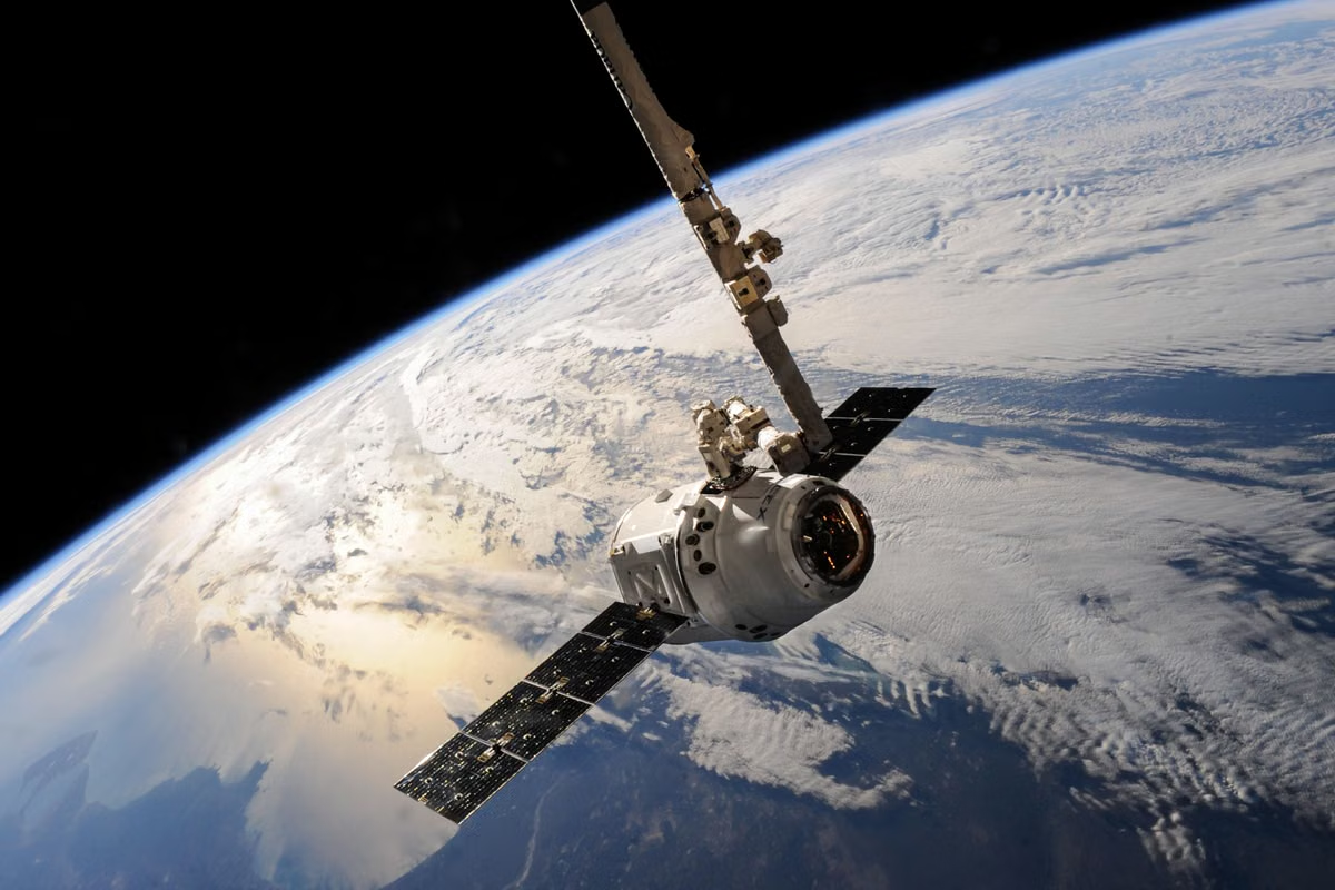
If a film makes satellite tracking look instant and all-seeing, this guide separates that fictional idea from real Earth observation. It compares data sources, update timing, visual presentation, and practical uses, then gives you a short checklist for judging claims about live tracking.
A map or movie scene may make it look as if one screen can follow anyone, anywhere, in real time.
Fast answer: God's Eye View is not a standardized public satellite product that can track any person on demand. It is commonly used for a cinematic, all-seeing surveillance idea. Real satellite data, 3D Earth simulations, and Google Earth are different things, and none should be assumed to provide continuous, gap-free person tracking.
This guide is for readers checking whether the cinematic idea exists in reality, students and creators comparing Earth visualization tools, and anyone unsure whether satellite imagery is live surveillance.
What does God's Eye View mean outside the screen?
The phrase has no single technical definition that makes it the name of one universal public system. Its meaning depends on context. In a film, it may describe a fictional capability. In casual conversation, it can be shorthand for a broad view assembled from cameras, maps, sensors, or databases. Those uses do not establish that one real satellite service can watch the entire planet continuously.
A clear example is Furious 7. The film's “God's Eye” is presented as a system for finding a person through connected cameras and digital traces. The production team describes the concept as part of the film's designed technology in its account of the God’s Eye concept, while the official film synopsis supplies the story context. That is evidence of a fictional device in a specific story, not a technical specification for a satellite product.
This distinction matters because the phrase can blur together several different capabilities:
- Satellite imagery records what a sensor observes over an area under particular conditions.
- A 3D Earth simulation presents terrain, buildings, or other spatial data in a three-dimensional interface.
- Real-time sensor data may report a changing condition, such as a sensor reading or a device location, if that data is available and connected.
- Person tracking means associating observations with a specific individual over time. It is not the automatic result of looking at a satellite image.
A system might combine some of these inputs, but each source has its own coverage, update schedule, access rules, and uncertainty. A globe rendered in 3D does not prove that its underlying information is live. A recent image does not necessarily identify a person. A location feed from a device is also not the same thing as satellite imagery.
Is God's Eye View a real satellite monitoring system? Not as a single, standardized public satellite product established by the cited materials. Treat the phrase as a concept or a claim until the speaker identifies a specific system, its sensors, data sources, update timing, and access limits.
Real satellite data: what it can show, and what it cannot
Satellite imagery is produced by sensors observing the Earth from orbit. The result is an image or data product for a particular place and observation time. It is not ordinarily a continuous video feed of every location. Whether a usable observation is available depends on the satellite's orbit and sensor, the target area, cloud cover or other viewing conditions, the product's processing, and whether the data is accessible to the user.
The timing alone helps explain the limit. The U.S. Geological Survey says Landsat 8 and Landsat 9 together have an 8-day revisit time for the same location under the stated mission arrangement. That is a repeat-observation schedule, not a promise of a clear image every eight days, and not a live feed. See the USGS explanation of Landsat 8 and 9 revisit time.
A processed product can have a different cadence and delivery delay from the satellite's pass. NASA's Harmonized Landsat and Sentinel-2 (HLS) documentation describes products with 30-meter resolution and observations typically available at a 2–3 day frequency, with latency depending on the product and processing. Those are product-level characteristics, not a guarantee that every point is visible in every interval. The NASA HLS product documentation explains the data products and their stated frequency, resolution, and latency.
These distinctions have practical consequences:
- A revisit is not the same as an update. A satellite may pass over an area, but an image might not be collected or made available in a form that suits a particular task.
- Clouds and viewing conditions can obscure the ground. A scheduled observation does not guarantee that the surface is visible.
- Resolution is not identity. Pixel size describes the spatial scale represented by the data. It does not automatically make a person identifiable or establish who someone is.
- Coverage is not continuous surveillance. A set of images from separate times does not become uninterrupted video simply because software displays them on a map.
- Access and processing matter. Raw observations, corrected imagery, and ready-to-use products may have different availability and delivery times.
Can real satellite data track a person as quickly as a film does? Satellite imagery alone should not be treated as a continuous, person-identifying tracking feed. The cited observation schedules show why: the products are collected and processed at defined intervals, and their availability depends on the dataset and conditions. A claim about tracking a particular person needs evidence about the actual sensor, supporting data, temporal coverage, and identity-matching method—not just a satellite image on screen.
3D Earth simulation: a visual model, not proof of live observation
A 3D Earth simulation is a way to display spatial information. It may show terrain relief, buildings, imagery draped over a globe, labels, or other geographic layers. Depending on the application, those layers can come from different sources and be captured or updated at different times.
That means “3D” describes presentation, not freshness. A detailed building model can be based on previously collected data. A globe can animate a route or overlay a changing dataset without continuously observing the real-world scene. And a model may simplify or generalize features to make the view useful and responsive.
How is a 3D Earth simulation different from God's Eye View? The simulation is a visualization method; God's Eye View is usually a cinematic idea about broad, powerful surveillance. A simulation may help explore spatial relationships, but the interface itself does not supply new observations or establish that a person is being tracked. To judge what is current, inspect the source and capture date of each layer rather than relying on the realism of the rendering.
For students and creators, this is a useful way to avoid a common presentation error: a smooth camera move from a globe to a street-level view can make different datasets appear to be one seamless live system. In reality, the globe, terrain, building geometry, aerial imagery, satellite imagery, and any live sensor layer may have separate origins and update schedules. A polished transition is an interface choice, not proof that every layer shares one timestamp.
When a 3D view is used in a report or video, identify the layers that support the claim. If the point depends on current conditions, cite the relevant current data feed. If it depends on a static model or older image, label it as a visualization or historical observation. Do not use “live” as a synonym for “interactive.”
Google Earth: explore and visualize, but check the image date
Google Earth is an Earth-browsing and visualization product. Google's documentation explains that its imagery is collected through sources including satellites and aircraft, and that imagery availability and dates vary by place. The Google Earth imagery collection explanation describes how imagery is gathered. Google's Earth product and version information describes the product's viewing and exploration features.
The key point for a reader is that a responsive globe is not necessarily a live sensor feed. You can move around the planet, zoom, and inspect imagery, but those actions change the view—not the age of the underlying image. Depending on the location and layer, visible imagery may have been collected at a different time from imagery elsewhere. A current-looking interface does not imply current capture.
Google also explains that imagery dates and sources can vary, and that image content should not be treated as a reliable way to identify a person. Its Google Earth education FAQ discusses imagery sources, update variation, and identification limitations. That is why a claim such as “Google Earth shows this person live” needs more than a screenshot: it needs a verifiable source and a timestamped data feed that actually supports the claim.
What is the difference between Google Earth and real satellite data? Google Earth is a product for viewing and exploring Earth imagery and geographic information. Satellite data is an observation or dataset that may be used in a visualization, but it can also be processed or analyzed outside that interface. The display tool and the underlying observation are related, but they are not interchangeable.
Compare the four ideas by source, timing, display, and use
Use these distinctions rather than judging a tool by how cinematic its interface looks:
- God's Eye View
- Nature: A context-dependent phrase, often a fictional or shorthand surveillance concept. - Data source: Depends on the particular story or speaker; the phrase itself does not specify sensors or data. - Timing: No standard update schedule. - Best understood as: A claim or narrative idea that needs a named system and evidence before it can be evaluated.
- Real satellite data
- Nature: Observations or products collected and processed by satellite sensors. - Data source: A named satellite mission and its sensor or data product. - Timing: Depends on orbital revisit, collection conditions, processing, and release. The Landsat and HLS figures above illustrate specific products, not every satellite dataset. - Best understood as: Evidence about an observed area at a particular time, subject to resolution and coverage limits.
- 3D Earth simulation
- Nature: A three-dimensional way to present spatial data. - Data source: May combine imagery, terrain, building models, and other layers. - Timing: Each layer can have its own capture or update date. - Best understood as: A visualization for exploring geography or communicating spatial relationships—not as proof of live observation.
- Google Earth
- Nature: A consumer-facing Earth exploration and visualization product. - Data source: Imagery and geographic content assembled from different sources, as described in Google's documentation. - Timing: Varies by location and imagery layer; do not assume a uniform or real-time update. - Best understood as: A way to browse and inspect geographic views, not a tool for continuous personal tracking.
A qualitative scorecard for common tasks
These ratings are an editorial fit assessment, not a measurement of product performance:
- Explore terrain and places: Google Earth — strong fit; a 3D Earth simulation — strong fit; satellite data — useful when the specific observation matters; God's Eye View — not a practical tool.
- Analyze land conditions from a dated observation: Real satellite data — strong fit when the dataset matches the question; Google Earth — useful for visual context but check the imagery date; 3D simulation — useful for presentation; God's Eye View — not a data source.
- Show a fictional, all-seeing tracking system in a story: God's Eye View — strong narrative fit; a 3D simulation — useful as a visual effect; real satellite data and Google Earth — do not establish the fictional capability.
- Follow a person continuously: None of these labels, by itself, demonstrates that capability. A separate, specific, lawful, and verifiable data source would have to support any such claim.
A five-step check before believing a “live view” claim
- Name the system. If a post only says “God's Eye View,” ask which product or dataset it means. A dramatic label does not identify a sensor.
- Identify the source layer. Find out whether the view uses satellite imagery, aerial imagery, a 3D model, or a separate sensor feed.
- Check the capture or observation time. A page's access time is not necessarily the image's capture time. Look for the date attached to the relevant layer or dataset.
- Read the update and resolution notes. Compare the stated revisit or product cadence with the claim being made. A multi-day observation product cannot substantiate continuous video.
- Separate location from identity. Ask whether the evidence actually identifies a person, or only shows a place, vehicle-sized object, or changing pixel. Do not infer identity from a map view alone.
Choose the source according to the task:
- If the goal is to browse places or explain geography, use Google Earth or another 3D visualization and disclose the imagery date when it matters.
- If the goal is to analyze a surface observation, choose a named satellite dataset with a suitable resolution, coverage, and capture time.
- If the goal is to show changing conditions, use a timestamped sensor or operational data feed designed for that condition; do not relabel an older image as live.
- If the claim is that a person can be followed continuously, require direct evidence for the specific tracking method. Otherwise, treat it as fiction or an unverified claim.
For developers building a mapping interface or processing geospatial datasets, the hard part is often not the globe view but handling the source files, timestamps, coordinate systems, and app behavior consistently. A cloud Mac environment can be relevant when a project needs macOS tools or iOS map-app testing; the ZekVPS Mac environment is one route to consider for that development setup. If the work is specifically an iOS mapping app, review the Mac support information before deciding whether a remote environment fits the testing workflow.
A personal computer can be inconvenient for a temporary project when it lacks the required macOS environment, must remain available for other work, or needs repeated setup across collaborators. Renting a Mac from ZekVPS can make sense for short-term development and verification, but it is not a substitute for authoritative satellite data, and it may not suit work that requires local physical connections or a continuously available dedicated machine. For this topic, the reliable path is still to verify the data source, observation time, and product documentation before calling any view real-time or person-tracking.
Put Satellite Claims in Context
Check the capture time and source before treating an image as live data.
Compare the data layer with the 3D rendering to see what is measured and what is simulated.
If you are moving MCP or Agents from demo to daily use, a snapshot-ready cloud Mac node beats swapping frameworks again. View ZekVPS cloud Mac mini plans — Separate lab from daily driver for calmer deployments.